Saturday, September 28, 2013

More Caving And Then Onward

We managed to get an electrical campsite in Lewis & Clark State Park because although the days were sunny, it was still windy and cool and the nights were quite cold. It’s nice to have a heater to take the chill off in the morning! Makes it much easier to get out of bed when you can’t see your breath, let me tell you. The magpies and mountain blue birds didn’t seem to mind it though. Neither did the mule deer. We saw the biggest herd ever – 8 or 10 does and fawns together.

Lewis & Clark Caverns was the very first cave we went into a number of years ago and the one I credit with getting me over my fear of being underground. It also created a desire to try other caves and we’ve found that each one we’ve tried has its own beauty. This one might be the most incredible though because of the many types of features it contains. So beautiful.

But first you have to get there! It’s a long uphill trail to walk with the guide to the entrance and at an altitude of over 5,000 feet it’s a bit of a slog for us sea level folks. However the view is spectacular enough to make up for it:
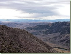
CavernsTrailView

That is snow on the highest mountains and the river below is the Jefferson. Lewis & Clark did indeed explore past here but they didn’t find the cave that ended up being named after them. That was left for later folks to discover. And plunder. Sadly there were many broken stalactites before sense prevailed and the caverns were protected.

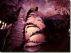
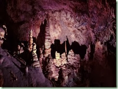
This cave system is a little tighter to manoeuvre in than the other two we saw on this trip. There’s even a spot where you have to get down and scoot, called the Beaverslide. Watching where your head is going at all times is very important. Being short is finally an advantage! Here’s a hint of what it looks like in there:

Caverns1

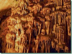
The pinkish lights are apparently newer and are supposed to give a closer rendering of the true colours. The older lights are browner:

Caverns3

The shapes are all so fantastical, aren’t they? Here’s another one:

Caverns2

They’re reminiscent of layer cakes and draperies, bacon and soda straws, ice cream cones and a baseball bat. Visitors have named the Lovers, the Sumo Wrestlers and even the North Pole with Santa. It took millennia to form them because it takes at least 10 years to create one tiny centimetre’s worth! Most of the broken bits haven’t even started to grow back. Although things are damp and some parts are drippy, interestingly there’s only one larger pool down there:

CavernsPool

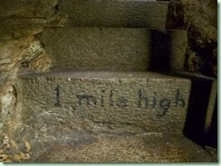
A little hard to see there in its own little grotto, it’s about 5 feet long and clear enough to see right to the bottom. While we were climbing up from the lowest level, the 19th step had this inscription:

CavernsMile

Yes, we were a mile above sea level – but still over 500 feet under the mountain! Although we’d been there before, it was still an exciting tour the second time around. And in case you wondered, the walk back was quite a lot shorter because we came out further down.

We stayed at the campsite for two nights in total and then headed off again, ever west towards home. We thought we might hit some snow in some of the high passes but only some fog instead. Pipestone Pass was particularly beautiful with rounded columns of rock that were quite unusual. Sadly, no photos because we weren’t stopping. Too far to go. We crossed the Great Divide and into Idaho (our 13th State) and finally our own Pacific time zone, then across the narrow part of Idaho and into our 14th and last State, Washington.

It was a bit tricky but I managed to navigate us to Riverside State Park, on the western side of Spokane and tucked beside the Spokane River. It was a small though busy campground but we found an electric site where we could watch the Canada geese flying in V’s up the river and the California quail scooting through the campsite. It had been a long drive from Montana so it was nice to relax while it rained intermittently all evening.

After some discussion we both decided we were getting rather tired of this marathon camping trip. Awww! The original plan was to head northwest from Spokane and go through the North Cascades before going home. But the weather has been unpredictable and cold at night and there are NO electric sites in North Cascades. In the deep, dark, damp forest. In the high mountains. Sorry, not going there right now.

Instead we went more-or-less straight across Washington to Lake Chelan (pronounced “shell-ANN”) State Park. It was an interesting drive, through rolling fields that reminded us of Saskatchewan and then down into deep coulees and up again. At Grand Coulee we crossed Dry Falls Dam at the end of Banks Lake. Finally we came down, down, down to the Columbia River were we turned north along the river for a little while among the orchards full of different types of apples and pears. So delicious you could even smell the apple fragrance while driving by! Yum.

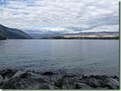
After crossing the river and switchbacking up the 4-mile Chelan River we got to beautiful Lake Chelan.

LkChelan

This lake is very deep and very long (50 miles!) and at its northern end it reaches into the afore-mentioned Cascades. The only way to get up there is by boat or plane because there’s no road. Happily the state park is only a few miles along the southern side so no boat was necessary – though that might be fun some day when we have more time.

The lower more “civilised” end of the lake is crowded with vineyards, orchards, hotels, inns and resorts. There’s two towns, Chelan at the river end and Manson, which is across the lake from our campground. We didn’t get much time to explore but it seems like a fun place to spend some time. Instead we’re heading home after only 2 nights here. It’s been a very long time – the longest that I’ve ever been away in my whole life! I miss my family, my home and my garden. Also hot showers, a warm bed, an oven, fresh vegetables and laundry facilities. And of course wifi anytime I want it. As you probably noticed, I didn’t find any convenient wifi anywhere since way, way back in South Dakota. Sorry to make you wait for the rest of the trip!

Addendum: Clicking the Ruby Slippers

“There’s no place like home!”

We’re finally at home safe and sound after a total of 59 days. Yikes! Turns out we left Montana just in time before the temps plummeted and snow fell. We also slickly avoided most of the big rainstorm today in Washington which flooded many areas – though it rained almost all the way from Lake Chelan. However we sure felt some of the force of that storm while heading for home across the Alex Fraser Bridge and the East-West Connector to the Knight Street Bridge this afternoon. Big puddles and lots of hard rain! Rooster tails on all the vehicles. Sploosh! We didn’t quite make it to our estimated October 1st deadline but enough is enough, right? It wasn’t supposed to be an endurance test. (But it sorta kinda actually was!) I’ll be back soon with a recap of The Great Cross Country Trek. But first I need a night’s sleep in my very own bed.
Across Wyoming To Yellowstone

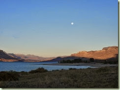
We went west again and out of South Dakota and into our 11th State, Wyoming. It was a very long day of travel and included all kinds of climates and weather. Standouts were the snow we were sprinkled with up in the Powder River Pass (elevation 9,666 feet) followed by switchbacks and incredible rock formations on the road just before a tiny town called Ten Sleep. (I so want to know how it got its name!) Then there was Cody, named after Buffalo Bill, with all its tourist traps facilities where we had to detour around the main street which was blocked off for some western shindig or other. Finally we followed the North Fork of the Shoshone River (which was a breathtaking canyon, but we were too tired to admire it as much as we should) and got a campsite on Buffalo Bill Reservoir just before dinner. Later the full moon made the scene magical:

BuffaloBillMoon

The beauty was a little lost on us because we just fell into bed exhausted after the day’s trip of about 8 hours and 3 gas fill-ups. You know you went a long way when you have to stop 3 times for gas, doncha think?

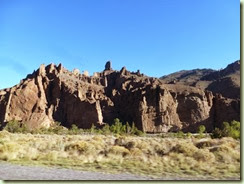
Next morning however we continued west along the Shoshone Valley and a whole bunch more incredible rock formations and hoodoos:

ShoshoneHoodoos

I grabbed a couple of shots while whizzing by without stopping. We were heading for the East Gate of Yellowstone National Park and Sylvan Pass (8,559 ft). There were plenty of signs of snow up there:

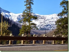
SylvanPassSnow

But who would have thought we’d find this:

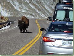
SylvanPassBison

A single bison wandering majestically down the highway wearing a garland of leaves on his brow! We’ve encountered lots of bison on the road before on this holiday but none so high up and so far away from its preferred territory. Plus there were no others around that we could see. We also didn’t manage to see a female grizzly that apparently decided not to cross the highway further on above Yellowstone Lake. The rangers had stopped the traffic (including us) just in case. And lastly, I never did see any elk in Yellowstone – though T did when he went for a walk without me.

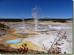
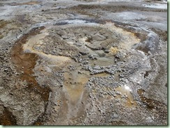
What we did see were many of our favourite geysers, hot pools, fumaroles and mud pots. Our first two nights there we stayed at Norris. We walked the mile in to see the Norris Geyser Basin which includes the delicately coloured Porcelain Basin:

PorcelainBasin

It is so surreal that it looks like no place else on earth! Then we continued to the Back Basin where we found that the gigantic but very irregular Steamboat Geyser had gone off in July so chances were it wouldn’t do it again anytime soon. We also visited all the other hot features around the boardwalk.

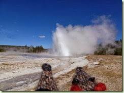
The next morning there was frost on the picnic table but we were prepared for the cold, knowing it would warm up later in the morning which it did. We drove down to Old Faithful Village and toured the boardwalks there. We were determined to see Daisy Geyser this time. This is one of the few regular timed geysers and we had missed it over several opportunities last time we were there. We were quite early, but Daisy was 15 minutes early too so the wait wasn’t that long.

FR DaisyGeyser

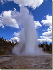
Good thing because the Flat Rats were getting impatient! We also managed to catch Grand Geyser although the wait was somewhat longer:

GrandGeyser

Grand is absolutely spectacular and has several smaller related geysers going off at the same time. It only erupts twice a day (once in the middle of the night) so it’s quite special to see. We were a little nervous while waiting because there was a bison getting closer than was comfortable but it ignored everyone as well as the geysers’ eruptions.

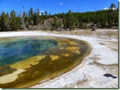
It was probably the same bison I had seen earlier. I call this photo Beauty and the Beast as it rested beside Beauty Pool:

BeautyAndBeast

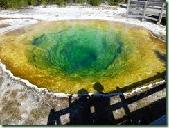
However I think Morning Glory Pool is even prettier than Beauty:

MorningGloryPool

Can you see the Flat Rats in the shadow beside ours? They like this one too.

I got geyser-kissed when Sawmill splattered drops of hot sulphurous water on me as I dashed by. Ouch! I thought it was rather rude since Sawmill is one of my favourites to watch its near-constant play. Another favourite is Anemone:

AnemoneGeyser

It’s pretty when empty but the two openings (the less-obvious one is behind this one) play off each other about every 10 minutes. They will fill, drain, fill and erupt 3 or 4 feet high and drain again with a sucking sound either together or alternately in ever-changing patterns. We watched them for nearly half an hour trying to find a repeat performance. We completed our day at Old Faithful with an ice-cream cone from the Lodge and a view of one of its regular eruptions. Turns out we had walked over 13 kilometres trying to see everything – no wonder my legs were tired!

On our last day in Yellowstone we managed to get a campsite in Madison which is closer to everything and so much harder to get into.

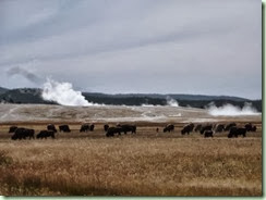
BisonAndGeysers

Everybody was photographing the big herd of bison near the Lower Geyser Basin. We checked out the Fountain Paint Pots and watched

ClepsydraGeyser

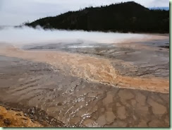
Clepsydra Geyser play for quite awhile. Then we carried on to the Midway Geyser Basin where I tried to photograph Grand Prismatic Spring but mostly only got the bacterial mats and a lot of steam.

GrandPrismaticSpring 

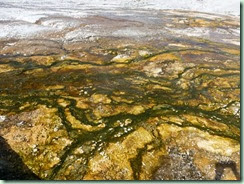
This is the largest pool of all and it’s really a pretty turquoise in the middle shading to green, and then the oranges and yellows and browns of the bacterial mats around the edges. Apparently the only way to get a really good view is to climb up the hill behind or to fly over. We only caught glimpses this time. The delicate bacterial mats are really pretty and very extensive here:

BacterialMats

As you can tell, we were really lucky with the weather which remained mostly sunny for the 3 days we were in Yellowstone and is continuing so far. The wind is cool and the nights are pretty cold though. We eventually left for our 12th State, Montana, got groceries in West Yellowstone and drove the rather scenic highway to Lewis and Clark Caverns State Park. More in the next post!

PS Posted when we got home. We found out that we’d just missed a couple of small earthquakes in Yellowstone the day after we left. Our timing was really good, huh?

Badlands & Black Hills

We’ve been through quite a few more adventures since my last post – even though it’s only been a few days. It seems to be getting harder to keep up and there are definitely few-to-no opportunities to connect to the Internet. No idea when this will get posted but there you go. You gets it when you gets it!

If I can remember that far back, I left you just before we went into Badlands National Park in South Dakota. These Badlands are incredibly beautiful! Here’s the view from our campsite:

BadlandsCampsiteView

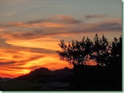
And it just kept going 360 degrees all the way around and with sunsets like this:

BadlandsSunset

The campground also had lots of meadowlarks and mountain bluebirds to brighten it up and the coyotes yipped and sang loudly in the night. The first day we got there we tried one of the shorter trails called Door:

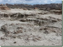
BadlandsDoorTrail

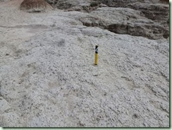
Do you see the trail? Neither do I! We had to follow these markers:

BadlandsDoorTrailMarker

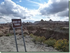
Until we came to the end:

BadlandsDoorTrailEnd

Yes, there was a sheer drop off after that! It was fun and not quite as hot as it could have been. We also checked out Window and Cliff Shelf but did not climb up Notch – too steep for me. It had rained recently and anywhere that was damp was really slippery. It dried quickly in the sun so later walking was much easier.

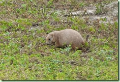
The second day we drove along the scenic loop road toward the western end of the park. We saw prairie dog towns:

PrairieDog

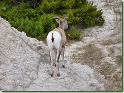
And bighorn sheep:

Bighorn

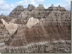
We didn’t see any of the resident bison though. The rocks gave a different view at every turn.

Badlands

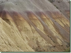
The rocks were as if someone had cut into a gigantic layer cake. Some were coloured from the fossils of ancient sea creatures and jungle plants: 

BadlandsYellowMounds

Absolutely fascinating. Photos really don’t do any of it justice.

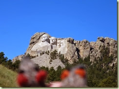
After two days at Badlands we headed west and a little north to the Black Hills for more adventures. We saw herd after herd of pronghorns as we drove by below the Badlands and then up into the hills. After squeezing through the multiple tourist traps that make up the small town of Keystone and nearly running over a wild turkey in the road, we found a pull-off to view the very famous Mt Rushmore:

FR Mt Rushmore

Then we drove down the exciting Iron Mountain Road around a number of “pigtail” bridges where we were chasing our own tail in a loop and through several single-car-sized tunnels:

PigtailBridgeAndTunnels

You could even see Mt Rushmore framed neatly in a double one (but our very hasty photos didn’t turn out). It was not for the faint of heart or large of vehicle!

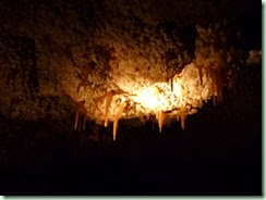
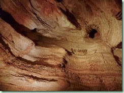
We had decided that we needed to go first to Jewel Cave National Monument, which wasn’t really on our original itinerary but was totally worth the trip out and back. The cave tour was about an hour and a half guided by the friendly and knowledgeable Lydia and began and ended with an elevator ride. These photos were taken only with the available lights in the cave, no flash:

JewelCaveStalactites

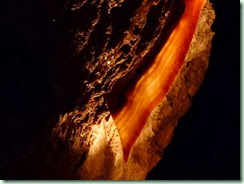
Little stalactites. And this feature is called cave bacon, really!

JewelCave bacon

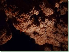
That’s just the end of the piece – the whole thing is 20 feet long and about an inch thick. Most of this cave is covered in textured calcite deposits:

JewelCavecalcite

I’ve got lots more dim photos but I won’t bore you with them. Right after Jewel Cave we went down to Wind Cave to camp overnight. We nearly literally ran into a herd of bison on the road in! Plus we heard several male elk bugling in the night. The wildlife here is an interesting combination of western and eastern versions as their ranges overlap. Apparently they have eastern bluebirds and mountain bluebirds, yellow and red-shafted flickers (and even intermediates between), and white tailed and mule deer. We saw a group of the latter this evening with their big animated ears grazing in the campground among the ponderosa pines. Things are starting to feel familiar!

It was interesting to compare Wind Cave to Jewel Cave. They’re only 18 miles apart and at slightly different elevations but quite different in feel. Our ranger guide this time was Clayton, who made it all quite dramatic. Here he’s showing us the original natural entrance to Wind Cave:

WindCaveNaturalEntrance

It’s even smaller than it looks – only 8” x 12” just inside the opening. Luckily we got to take a much larger revolving door instead! Teeny spaces are not my thing though the ones we went through were definitely smaller than the tour at Jewel. The formations didn’t have the thick layer of calcite crystals.

WindCave1

There weren’t any stalactites or ‘mites at all. But this beautiful formation called box-work was everywhere:

WindCaveBoxWork

Apparently it’s very rare and Wind Cave has most of it found in the world. There were some sparklies like these “frost” crystals:

WindCaveFrostCrystals

But mostly it was just fascinating rock formations and narrow passageways. Loved it all! This isn’t our last cave adventure either. We’re planning to go back to the Lewis & Clark Caverns in Montana after Yellowstone, which is where we’re heading for next. Sorry we couldn’t do or see absolutely everything in the Black Hills. There’s just so much here! More caves. Mammoth fossils. Crazy Horse. Deadwood. We’ll just have to come back again some day.

This unfortunately couldn’t get posted until we got home. But here you go anyhow. More anon.

Sunday, September 15, 2013

More Dancing With The Trucks

Yet another long freeway drive (nearly 7 hours) from Michigan around the foot of that Great Lake, through a sliver of Indiana, by Chicago at rush hour (yikes!) and west in Illinois and then northwest into the middle of Wisconsin. Four states in one day! By far the worst part was the toll freeway that started just past the Indiana/Illinois border south of Chicago and went north and west by that city and we only caught a smoggy glimpse of its high-rises. Instead of the system like New York’s where you get a ticket when you get on and pay whatever you owe when you get off depending on how far you travel, this one had you stop every 10 miles or so and pay again. And again. And again. They do have a transponder system but of course we didn’t have one so had to go far over to the right each time to the gates where you can pay cash. I’d check the payment sign (mostly $1.50 but once a much as $3), fish out the cash, hand it to T as he was rolling down the window, he’d hand it to the cashier in the toll booth, they’d lift the barrier and we’d be off again and back out in the crazy truck traffic. We’d lost track of how many times we did this tricky feat but it was at least 8 times for approximately $15 total. We were starting to get quite deft at it by the the time we got to the Wisconsin border north of Rockford and the end of the toll freeways.

Maybe we wouldn’t have minded the tolls so much if the traffic wasn’t bumper to bumper with a gazillion transport trucks and everyone coming and going, on and off ramps, very fast. We had to change several times to stay on the right road. Then one whole section of over 30 miles was under construction and we couldn’t go faster than 45mph. It took a great deal of concentration and patience on both our parts just to make it out of Illinois in one piece! We treated ourselves near the end to delicious gyros when we stopped for lunch and gas at one of the “oases”. These rest stops are built over the toll freeway and are like a mall food court. No wifi though sadly. At least our lunch break gave us the fortitude to carry on.

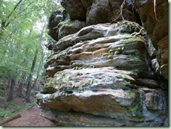
Wisconsin was much more relaxed thankfully and we finally found Mirror Lake State Park even though there was no signage from the main highway. It was very quiet and peaceful after our crazy day. I was photographing many of the trees, very few of which are familiar, for later hopeful identification. We walked down by the lake and then to an interesting sandstone rock formation, Echo Rock.

EchoRock2

EchoRock

The trail went all the way around its edge. The weather was much cooler than it had been further east and less humid too. So much more pleasant to travel in.

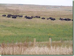
Even though we were pretty tired of long travel days we decided that we would press on the next day anyhow. So we continued across the western half of Wisconsin and crossed the bridge at La Croix over the Mississippi River into Minnesota. The highway followed the river for a short way north but then turned west again over a few mountains and across the prairie which was kind of boring with hardly anything but corn and soy fields everywhere. Our chosen state park was Blue Mounds, a long high bluff in the middle of the farmland. The campground is tucked in among shady trees though we could see the cornfields from our spot. The first evening was warm and sunny and we walked out to see if we could see the park’s resident bison herd. Nope. It was nice to stretch our legs after so much driving though. The Flat Rats found a nice bed:

FR bed

OK. Maybe not so nice!

The park had a really nice paved bicycle trail so after breakfast next morning we decided to try it out. When we got to the park office the bison were moving quickly away from us behind their fencing.

BlueMoundBison

If we’d been a few minutes later we probably would have missed them entirely. This is our third bison herd this holiday but likely not the last. Too bad I can’t get any of that luscious bison down but I’m not about to get that close! 

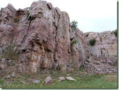
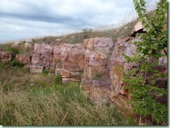
The Blue Mounds were called that from the way they looked from out on the prairie. Up close the rocks are Sioux quartzite in a beautiful range of pinks, reds and purples. We investigated the old quarry:

BlueMoundsQuarry

From 1919-1937 the rock was used for building but mostly for crushing to use in concrete for highways in the area. It’s very hard and durable and just lovely.

SiouxQuartz

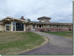
In the 1960’s author Frederick Manfred built a house up on the bluff from the quartzite and other local recycled materials. It snuggles right into the stone behind and commands a view of the prairie and the town of Luverne below.

ManfredHouse

The park uses this house as a nature centre but it’s currently off season and closed. We peeked in the windows and there’s a fabulous huge stone fireplace that must have heated the whole thing nicely.

We were glad to get back to camp before it rained more and the wind picked up quite a lot. An enforced rest is very welcome! Today we’re in our 10th state, South Dakota, and right at the entry to Badlands National Park. Happy to borrow some free wifi! And then it’ll be Mt. Rushmore and the Wind Caves. It should be relatively easy sailing from here on now that we’re beyond the most populous areas and there’s less traffic on the highways. More in the next post from Who-Knows-Where!

Falling In And Out

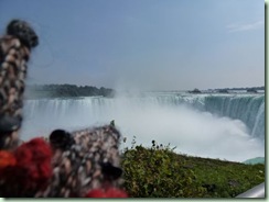
When last I posted we were on a New York interstate toll highway on our way to Niagara Falls. We managed to see quite a lot of the top of the falls on the US side by taking the scenic parkway before we crossed over another border crossing in the middle of the Rainbow Bridge. It was relatively painless (apart from the tolls everywhere) – we didn’t make any wrong turns and the border guard (female) wanted to know more about our van and our trip than about anything we were bringing back into Canada. The Canadian side was much more spectacular and we walked along on the view wall for plenty of photos. Saw both sections of the falls and lots of mist and rainbows.

NiagaraFalls

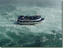
Here’s the Maid of the Mist with its passengers all in blue slickers.

MaidOfTheMist

Nearly left in annoyance but finally found where they hid the Journey Behind The Falls and went down in an elevator carrying our souvenir yellow slickers to the tunnels.

FallsTunnel

They were rather damp and noisy but kind of unspectacular until we got out onto the decks below the lip of the Rainbow Falls (Canadian side). I had taken off my slicker because I was suffocating in hot plastic and wetter on the inside from perspiring so I got completely and refreshingly soaked from the spray off the falls! Managed to keep the Flat Rats dry because they weren’t too excited about getting wet. Kept the camera dry too so no photo. Disappointed that the souvenir photos the concession took on our way in were both unflattering and very expensive at $25 for two different ones so on the way out we unanimously declined them.

Off again down the road to our provincial park for the evening, Rondeau on Lake Erie. It was another interminable trip on freeways and dancing among the big transport trucks. We didn’t get in until late and the registration booth was closed so we just settled in, did 2 loads of laundry, had showers and supper and repacked the Black Box which had water in it from that morning’s rainstorm. We left again very early before they opened in the morning so if they’re not going to supply us with self-registration envelopes and a secure drop-box instead, they are out of a payment. It would have been nice to explore the park more but the bugs there were seriously annoying. The little bats we saw were just not keeping up! Before we could stop them, the van was filled with flies and mosquitoes who nibbled on us all the hot and humid night long.

Woke up to our theme music alarm in the dark and got going relatively early while enjoying a gorgeous sunrise over Lake Erie as we drove by the shore. Yet another long drive on freeways, which included rush hour in Windsor, incredible numbers of big trucks, another toll bridge with the US Customs at the end of it just before the toll booth and two separate freeway entries right after. The border crossing took awhile but was quite easy with a slightly less-tough-than-usual guard. We made a little blunder on the Detroit freeways (which wasn’t hard to do!) and missed a turnoff because of traffic but managed to find a way around it. By that time the bad morning traffic had chilled some anyway. Didn’t really see anything of either Windsor or Detroit. You usually can’t see much of anything from freeway corridors and we drove all the way across the whole state of Michigan viewing only trees, billboards and the occasional rest area. Kind of boring actually but it gets us west much faster than meandering side roads. We’re both feeling rather sick of freeways but we’re considering this part of the trip a challenge rather than the pleasure it might have been.
We didn’t find a grocery store anywhere today (fast food doesn’t count) so we’re on our last supplies. However we finally found Van Buren which is a state park on the sandy shore of Lake Michigan. Our 5th Great Lake – and the 3rd one in three days!

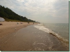
The area has dunes and at first glance is reminiscent of the Oregon dune area that we’re very familiar with.

LakeMichigan

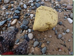
As usual it doesn’t smell like the ocean. There are mussel shells, pretty pebbles and waves but no salt, seaweed or tide. The Flat Rats found a little piece of the Yellow Brick Road:

FR yellow brick

They were wondering where the rest of it was and what happened to Dorothy? Hoping the Flying Monkeys didn’t have anything to do with the mystery. We’re all scared of Flying Monkeys.

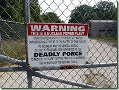
The campground is nice and electricity is in every site so we could plug stuff in. Frighteningly we discovered it’s situated right next to a nuclear power plant. Um, lovely.

NuclearPowerPlant

See? Hope we don’t glow in the dark later. Perhaps that’s where the Flying Monkeys originated? Do wicked witches live at nuclear power plants?

We’ve seen mourning doves, flycatchers, pebbles, Petoskey stones (a fossil coral gemstone) and beach glass. The mosquitoes were still biting but the bugs were certainly better than Rondeau Provincial Park. The weather was still hot and humid with high cloud that thankfully muted the sun a little.

The health of our old Volkswagen Westphalia, both our transportation and our home, remains good. Happily she has been working well since her blood oil transfusion. We’re quite confident that she will get us home now. However, I’m still dreaming of maps every night! Can’t guess why.

I’ll be starting a new post but will have to post them together whenever I manage to find available wifi. It seems to be less common anywhere here in the mid-US except at motels. Humph. We don’t have time to hunt for it.