Friday, September 26, 2014
Still On The Road!
Soon, my darlings!
Friday, September 12, 2014
Desert To Ocean Trip – Part 5
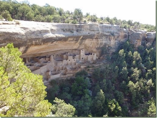
Here it is Day 17 and we’re still in Mesa Verde National Park, Colorado. There’s just so much to see! We’ve nearly emptied the gas tank because all the good stuff is quite a long way away, a 36-mile round-trip back to camp. On Day 15 we went on both of the available ranger-led tours of the cliff dwellings, Cliff Palace and Balcony House. They were very interesting and we spent quite a lot of time listening to history and culture lessons. It wasn’t at all boring since we were standing where the Ancestral Puebloan people stood 800 and more years ago. It was also quite strenuous! Here’s our first view of Cliff Palace:
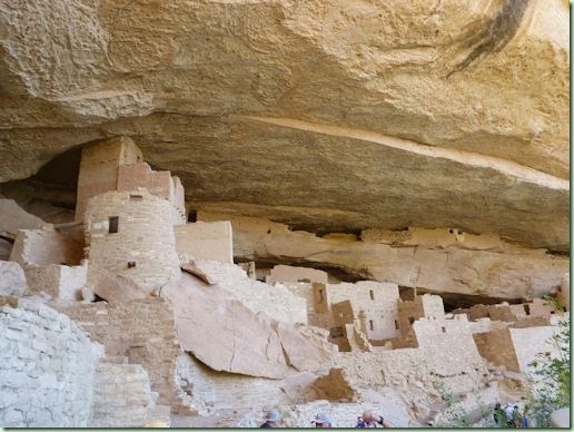
It’s rather beautiful – even if I would never have wanted to live there. We had to climb around down a steep trail with stairs to get down to it. I’m sure it was a lot easier for us than for the original inhabitants who only had ropes, ladders and finger and toe-holds in the rocks to move around! Here’s a detail from down below:
The stonework was really impressive since they only had stone tools to work with. Balcony House was even harder to get to. We had to climb ladders:
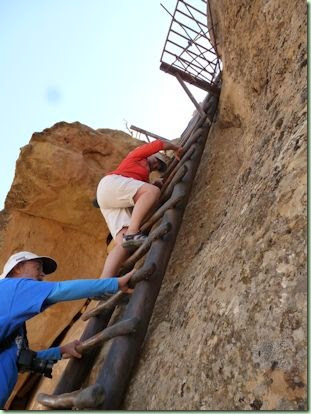
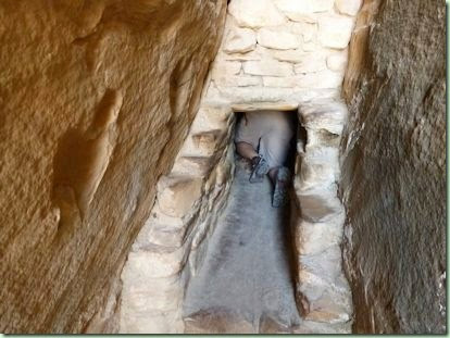
…including a 30-foot one and we had to shimmy through some tight places:
Everyone made it just fine! Fun at 7,000 feet above sea level.
Day 16 we went to another cliff house, Spruce Tree House:
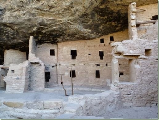
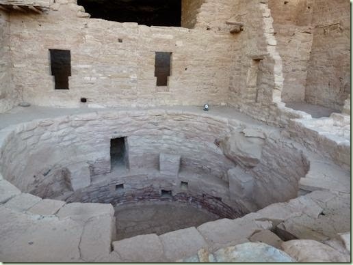
The T-shaped doors have inspired lots of speculation on their meaning and purpose. Many of the cliff dwellings have them. We also learned a lot about the kivas (round underground rooms) which were plentiful everywhere.
The contemporary thought has it that they were clan gathering places, whether for work or other reasons, perhaps ceremonial. We climbed down into the only one with a restored roof:
Gotta say, if people were trying to do fine handwork down there, there sure wasn’t much light for it! We also explored the museum which was very informative, if slightly old-fashioned. Plus we almost lost the Flat Rats! We got back to the van and the little beasts were missing from my bag! I totally thought that was it for them because I sure wasn’t going to re-trace every single step that day. Fortunately Thom saw a lost-and-found sign and went to inquire if anyone had turned the critters in. Nope. (Do you know how hard it is to explain Flat Rats to the Muggles?) Then on a whim he went back into the museum and there they were – stuck down between a stair and a ramp. He only just managed to notice them because he went through the place backwards to the general direction of the displays. Grrr…I put the Flat Rats in time-out for awhile until I got over their AWOL affair. I swear I was ready to leave them in Mesa Verde with the lizards and the ground squirrels.
Today, Day 17, we hiked the Petroglyph Point Trail. You know how much I love petroglyphs! The trail began with the Spruce Tree House trail near the museum but split off and became rocky quite quickly. We signed in at the registry box (so they can track who’s out there) and carried on. A most interesting trail!
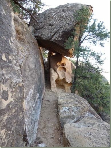
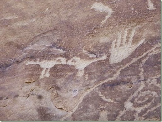
Here’s one bit where you had to squeeze between the rock walls. This was just wide enough for me if I went sideways, otherwise my hips were in the way! There were plenty of steps cut into the rocks and it followed along the cliffside for several kilometres. We finally came to the petroglyphs. I particularly liked these two birds, beak-to-beak:
The Flat Rats were wondering where the pictures of their ancestors were:
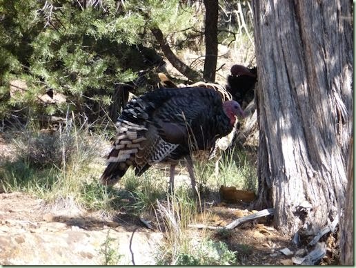
We looked but we didn’t see anything particularly rat-shaped here. Further study is necessary, I think. After this we were happy to find that the trail went up onto the mesa and was fairly flat and easy on the way back. We weren’t really up for a return along the cliff face at that point. On the way back we saw a flock of turkeys. These guys are big! We were wondering if they were actually the descendants of the ones the Puebloans had tamed for eggs and feathers. These were their only domesticated animals except for dogs.
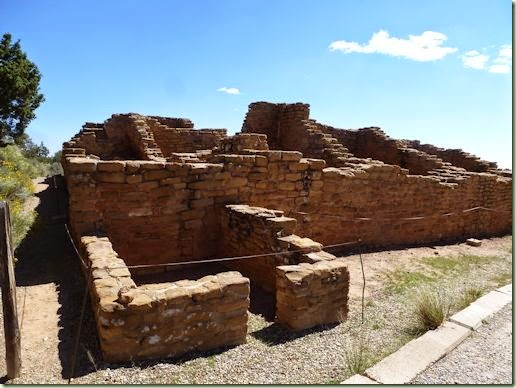
After we got back we continued back toward camp and stopped at the Far View village sites. These were unlike the cliff houses because they were safely on flat land:
A bit less alien really. So much to see and learn. And to understand that nobody knows very much about how things really happened here. Especially why this whole place was abandoned around AD 1300.
Anyway, we plan to abandon it ourselves tomorrow morning. We have a bunch of errands to run in Cortez, the nearest town, before we head off to Arizona. We decided to skip Chaco Canyon, New Mexico, because of the bad roads in to it. Our muffler has a loose connection and we’re concerned about losing it while driving over washboard surfaces. Instead we’re heading for Antelope Canyon and Lake Powell for one night and then on to Grand Canyon’s South Rim where we have reservations at the campground for two nights. At that point we’ll be a day ahead of my original plans. We’ve been spoiled the last few days for Mesa Verde’s cool nights but warm sunny days – not really hot at all. I think it’s going to be back into the frying pan very soon!
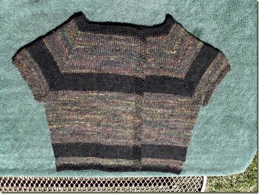
Speaking of warm sun, I took advantage of it and a water supply to wash and block my Handspun Sassymetrical Sweater:
It’s quite a bit darker than it looks in this picnic table shot in the bright sunshine. Also probably looks much better on a body but I’ll have to wait until it’s dry and it’s cool enough that I don’t melt into a puddle of goo if I put it on.
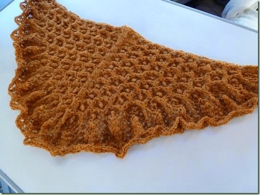
I also finally, FINALLY, finished the Autumn Echo Flower Scarf that I started way back last October. It looks very wrinkled and teensy right now and I can’t block it until we get home since I didn’t bring the blocking wires with me.
Great texture there though, huh? More on this scarfy thing later.
I also had to frog a section of my Travelling Shawl because I didn’t like the plain dark navy next to the rest of the yarn. It didn’t play as nice as I wanted so I hauled it back and added some navy/purple sock yarn in between. I may make it a little longer as well so I hope I don’t run out of yarn in a bad place. There isn’t any more! I’ll be working on it tomorrow as we travel. Travelling Shawl. Get it? <snort!> I crack myself up.
So, more soon. However I have no idea when we’ll get wifi access again. Especially as nice as this one is! We deliberately camped in this spot because it was near the washroom which has the wifi network. Yeah, wifi from the loo again. It’s a trend, I tell ya. I don’t care as long as it works! Anyhow, another day, another state.
Tuesday, September 09, 2014
Desert To Ocean Trip – Part 4
So I guess I’ve missed telling you all about Arches National Park, Utah. It’s a busy place! Lots of tourists from all over the world. I heard French, Chinese, Spanish and German as well as English in several accents. We couldn’t get into the campground in the park as usual so we went to our favourite fallback campground just outside the park boundary along the Colorado River, Goose Island. It’s run by the BLM (Bureau of Land Management) and devoid of fancy amenities but it does have clean pit toilets with an adequate supply of tp. That does become rather important when you’re camping, believe me! No water supply though but we were prepared.
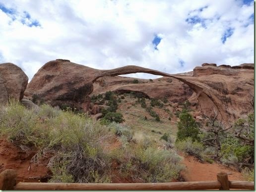
Arches has 40 miles of (twisty & scenic) road to get to some of the important arches. We went first to the end of the line at Devil’s Garden and went for a hike. This one is the widest arch, Landscape:
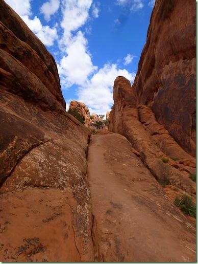
I’d not forgotten how hard the trail gets after this but it was worse than I remembered. Or else I’m several years older! There’s a long uphill on a narrow ledge of slickrock with sloping sides:
You can see the people ahead of us on the worst bit with drop-offs on both sides. I literally crawled up on all fours! And later of course I had to get back down again. Ugh. This may be the last time I ever do that trail. I’m not good with heights at the best of times and my balance is somewhat compromised with otoconia (ear rocks). There was another bad spot later on and I decided not to go past the really narrow and very high part. It was frustrating watching others waltz past me with sure feet and a baby in a backpack! And a 30 foot drop on both sides. Nevermind.
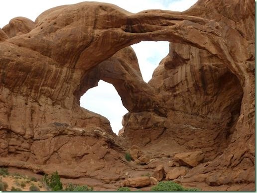
We were able to see quite a lot anyway. This one is the massive Double Arch:
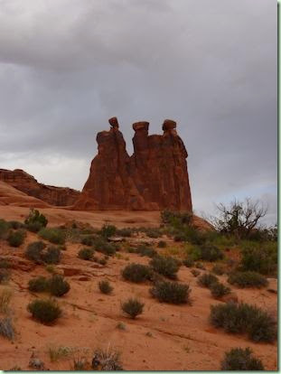
It was hard to photograph things without too many random people in the frame. And there’s just so much to see! We also walked the Park Avenue both ways. The trail is not hard and mostly in a wash surrounded by walls with different shapes. Just outside one end is my favourite rock formation in the park called the Three Gossips:
They look quite different depending on which angle you view them from. There are quite a few rocks that look like people or animals (a Sheep Rock and Parade of Elephants). All you need is a good imagination. The second day at Arches was overcast (thankfully!) and sprinkles of rain kept us cooler than we might have been. But that night there was yet another thunder and lightning storm including lots of rain which continued on and off into the next day. It was hard to sleep with all the windows shut in the still-considerable heat.
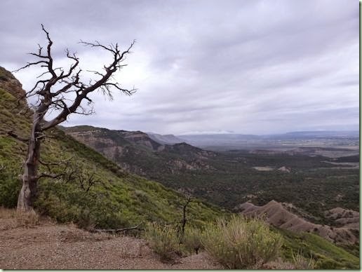
Day 14 was quite rainy so we weren’t especially sad to leave Arches and head for Colorado and Mesa Verde National Park. Since the rain decided to follow us we could only view the scenery through the mist and clouds. Mesa Verde is quite different from Arches and the rocks are yellow and covered in Gambel oak, pine and juniper. Here’s a park viewpoint as the rain was coming in again:
You can see how very high up this is! Nearly 9,000 feet above sea level. And it’s a lot cooler here – at least at the moment. The road snakes back and forth following the rim and even goes through a tunnel. This afternoon we spent getting settled in the huge campground (with wifi from the campsite– yay!) and getting much-needed showers and doing laundry. Tomorrow we’ll go on a couple of the tours of the Anasazi Ruins which are quite a long way away on the switchback road.
More soon! We’ll be here for a couple more days anyway.
Desert To Ocean Trip – Part 3
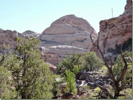
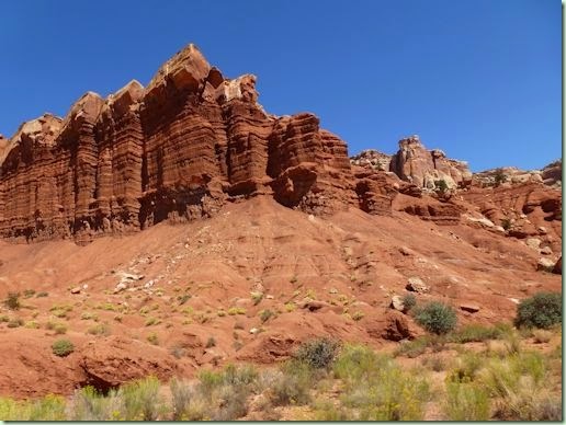
As I mentioned in the last post, Day 9 began with a long drive to Capitol Reef National Park in central Utah. Here’s the Capitol Dome that gives it part of its name:
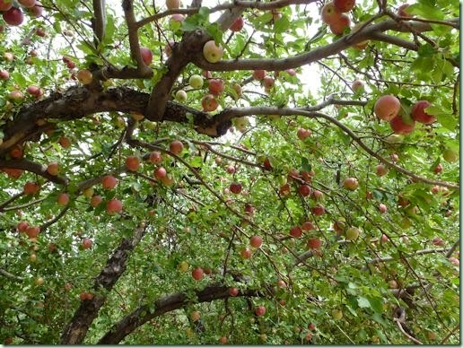
We were lucky and got a campsite near the orchards in Fruita, formerly homesteaders’ lands before the park was set aside. There are still lots of fruit and some nut trees here. Currently the pears and apples are ripe:
You can pick a few for personal consumption or pay a small fee and pick lots. They have ladders and picking poles for your use when each individual orchard is open. There’s nothing like it in any other public park! We managed to snag half a dozen to squirrel away for later, plus one each to eat right away.
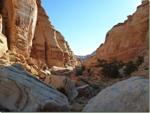
On Day 10 we were still in Fruita. We got up early enough to go for a hike up our favourite Cohab Canyon trail:
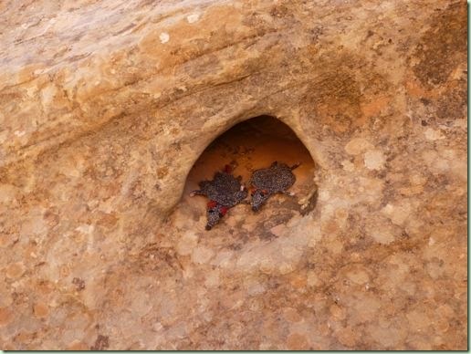
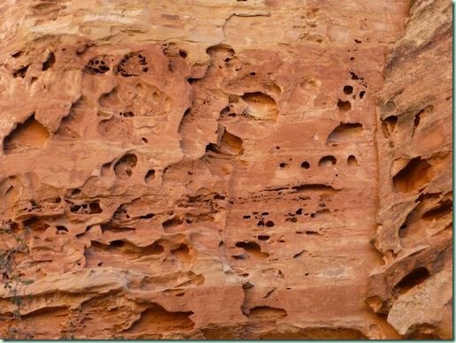
First you zigzag up and up above the campground and then you find this magical little slot canyon. Yes, there is a trail there somewhere! The Flat Rats found themselves a wee sandstone cave just their size:
There were lots and lots to choose from!
At the other end of the trail you switchback down again to meet the highway. We walked back along the road so we could visit the petroglyphs:
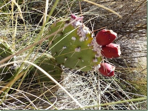
I love these bighorn sheep! There were lots more shapes but the light wasn’t particularly good for photographing them. I also found some of the opuntia cactuses that not only had red fruits but cochineal insects:
I was good however and left them (and their red dye) where they belong! The late afternoons evenings in Capitol Reef were electrical – thunder rolls around and around the mountains with flashes of lightning and occasional showers. We wisely tried to keep our hiking early enough to avoid both that and the hottest part of the day. Didn’t help though when we were trying to get to sleep early and cracks of thunder kept waking us up.
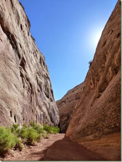
Day 11 we drove up the scenic road and hiked into Capitol Gorge.
We saw a little bat (in daylight!) and several lizards on the rocks and tiny toads in the damp mud of the wash. There’s also more petroglyphs and signatures of some of the pioneers back to the 1800’s. (No, you aren’t allowed to add yours!) We had lunch at the Grand Wash but we didn’t go too far down it because we were quite tired by then and it was getting hotter. Also we were running out of ice and it was a 20-mile round trip to get some in the little town of Torrey. Obviously the heat has been pretty intense because a block of ice doesn’t even last much more than 2 days. And we can’t always get blocks. Party ice melts even quicker! Don’t want what food we have to spoil, do we?
I had fun trying to photograph the amazing rock formations while we were driving by them. None of the pictures does this place justice at all. I’ve tried to give you a little hint which is the best I can do. It’s one of my favourite places.
And I haven’t even mentioned my knitting yet. I finished a rather randomly stripey version of the Sassymetrical Cardi in handspun using the leftovers from my Rainbow Dark sweater and the skein of black Shetland that I spun before we left home. I used nearly all of both yarns for a short puffy-sleeved version. It’s not been blocked yet. First I didn’t have water (Antelope Island) and then I didn’t have drying time (Capitol Reef). But it’ll get done eventually. I also started and half-finished a Lala’s Simple Shawl in several leftover sock yarns. This is my mindless knitting for the road. My fussier knitting for when I have quiet time in camp is the Echo Flower Shawl that I started last year and haven’t touched until now. I’m on the final edging chart so it should be done in a couple more days. It won’t get blocked until I get home though. I didn’t bring wires or enough pins! It will wait.
So next it was off to Arches National Park on Day 12 for a couple of days. We couldn’t get adequate wifi in Moab and I never got a post written (bad blogger!) so you’ll have to wait a little longer for Arches Days 12 & 13. Currently we’re in our 5th state this holiday, Colorado, and a new state for us. There’s wifi here in Mesa Verde’s Morefield campground! Yay! More soon.
Desert To Ocean Trip – Part 2
Well, where the heck did I leave off? Oh yeah, on Day 4 we were on our way to Farewell Bend State Park, just on the border of Oregon and Idaho. That night we had a little bit of a storm with thunder and some rain. Just enough to cool things down some. The next morning it was into Idaho, state #3 for us this trip, as we headed for Craters of the Moon in the eastern part of the state for Day 5. This place is amazing! Lava flows and craters everywhere you look. This kind is called pa-hoe-hoe (ropey lava):
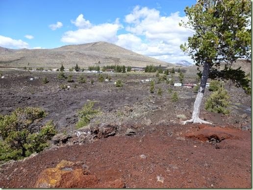
The even more broken up and pointy stuff is called a’a (meaning “ouch-ouch”). Yes, they get the terms from Hawaiian because that’s where this volcano stuff has been really well studied. Our campsite is in the middle of it:
Oh, sorry. Guess you can’t see our little Westie too well there. Here, try this:

There she is! Tucked in a little spot among the lava. It wasn’t quite as hot as it looked because there was a cooler breeze blowing that made it quite bearable. So we went for a walk along the North Rim Trail. It was really interesting to follow a series of craters. Some we got to walk down into:
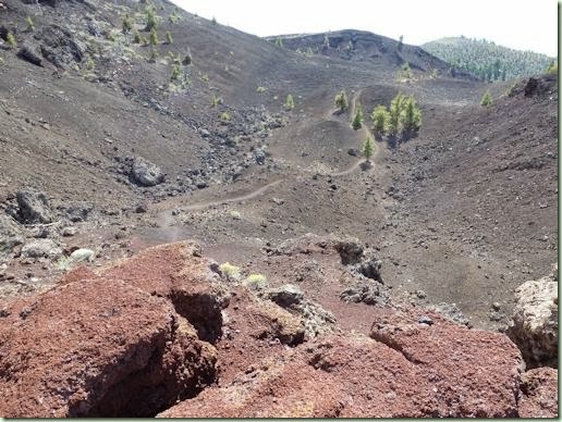
And some we skirted the rim:
We didn’t really want to walk back up and down along the same trail so we went back by the road – a total round trip of nearly 10K. Whew.
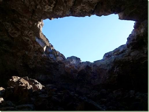
Next day, Day 6, and still in Craters, we drove around the loop to the lava tubes trail. We did 3 of them. This one is the biggest, Indian Tunnel:
It’s relatively easy because most of it has openings that let in the light. The end is a bit of a scramble and a squeeze though:
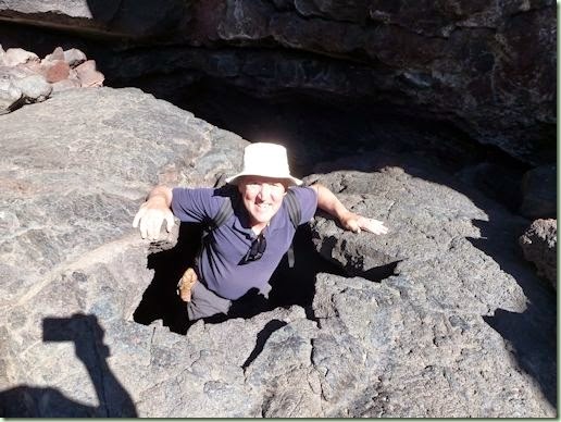
And then you get to walk back over the pa-hoe-hoe directed by markers. But that was not nearly the squeezes it took to get into Boy Scout Tunnel! That was a tight one and I was really proud of myself for not being at all afraid to climb into such a small entry. I enjoyed seeing the bits of ice left inside that one. We also did the larger Beauty Tunnel, which is only open partway due to a rock fall. It has some pretty sparklies on the ceiling which I guess must give it its name.
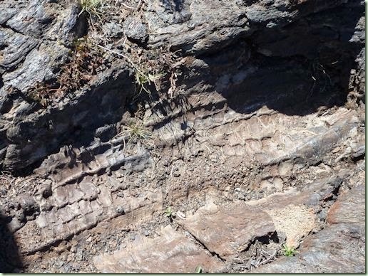
After that we drove out to the Tree Molds trail. Yes, another set of trees that had gotten themselves swamped by the lava flow and left their impressions in the rock:
This stuff is fascinating – at least to us!
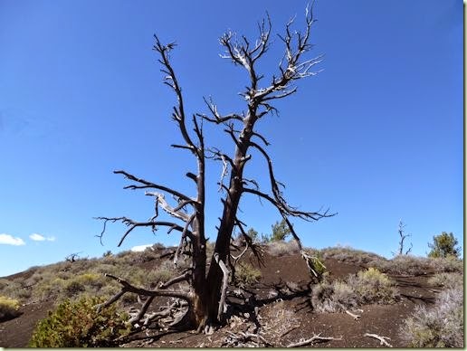
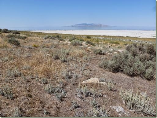
We enjoyed our stay at Craters but on Day 7 it was off to state #4, Utah. We got groceries on the way to Antelope Island State Park in Great Salt Lake. Here’s the view from our campsite out over the salt pan to the super-salty water and the misty island and mountains beyond:
It looks rather desolate there but it had the most wildlife we’ve seen yet: bison, pronghorns, deer, jackrabbits, birds (chukars, meadowlarks, pelican, gulls, sandpipers) and the life of the lake itself, brine shrimp and clouds of brine flies. 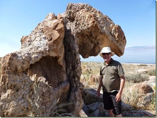
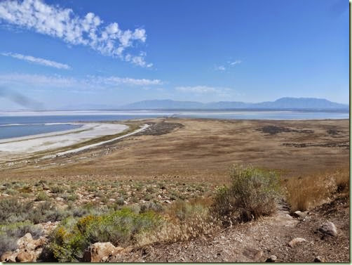
This is my buddy, the Gargoyle Rock. No, it didn’t eat Thom. But it was a very interesting shape! On Day 8 I waded in the lake and got all salty! It’s 3 times the salt of our ocean beaches. It also smells rather unpleasant and is kind of gross but that didn’t stop several people from floating in it. I wasn’t inspired to go that far though! We weren’t able to drive down to the Garr Ranch at the end of the island because of a bicycle race so we contented ourselves with hiking up Buffalo Point lookout instead:
You may be able to just see the long causeway which is how you get onto the island towards the top centre of the photo. We had trouble sleeping that night because of the strong winds which blew the canvas on our van noisily. Thom got up and shifted all the stuff from the top level and closed the pop-top up so we could sleep. But on Day 9 we were up earlier than the sun so we could get an early start through the Salt Lake City and Provo morning traffic. We took full advantage of the HOV lane and buzzed through the busy corridor as quickly as we could and then headed down quieter highways to Capitol Reef National Park.
I’ll leave this post here because it’s getting rather long. Saga to be continued on the next post!
